
Seismic-noise recording system with real-time data visualisation
Patents for licensing
The Engineering and Earthquake Risk Group (GIRS) has developed a comprehensive system for the synchronised and simultaneous recording of environmental vibrations (also known as ambient noise or seismic noise) by means of a sensor array. After that, by means of the corresponding analysis, the dispersion curve of the surface waves or Rayleigh will be obtained, which will allow us to characterise the soil.
This invention solves the drawbacks of current systems and is characterised by the creation of a Wi-Fi network for communication between nodes and server or by its real-time data display.
The group is looking for companies interested in acquiring this technology for its commercial exploitation.
INTRODUCTION
Recent studies around the world have demonstrated the importance of local geology in seismic disasters and their consequences. Ground motion can be drastically amplified, depending on the particular characteristics of the subsoil, increasing the seismic effects. Therefore, soil characterisation becomes a crucial issue in seismic risk studies, particularly in urban areas located on soft sediments.
Ambient seismic noise corresponds to vibrations on the earth’s surface due to different natural and man-made causes. These vibrations are imperceptible to humans, but not to seismic sensors. Therefore, their recording and analysis provides valuable information about the properties of the medium they pass through, i.e., the characteristics of the ground.
This characterisation can be carried out using different methods, such as array techniques, which make it possible to obtain the propagation speed of waves through the medium as a function of frequency, known as dispersion curves.
In terms of implementation and resources, these techniques require several sensors and a multichannel digitiser to record several signals simultaneously. The acquisition of these digitisers, together with the corresponding sensors, involves a significant financial outlay which is often not accessible toall research groups. As a result, advances in research related to subsoil characterisation or seismic hazard are often limited by the excessive cost of the necessary instrumentation.
In addition, most of this equipment is wired, which makes it difficult to implement in certain urban environments, where the arrangement of the geophones must be adapted to the available free spaces and their geometries.
On the other hand, in some cases, data recording is done locally at each node of the sensor network. Even in some systems it is not possible to visualise data in real time, which prevents the detection of errors in the field, with the economic cost of having to travel again and repeat the measurement.
For all these reasons, the present invention focuses on a proposal for an integral system, economically and technically viable, based on the acquisition of ambient noise by means of a network of seismic sensors, and which provides a solution to the technical problems mentioned above.
TECHNICAL DESCRIPTION
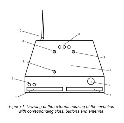
The system of the invention (see Figure 1) makes it possible to record wirelessly on a single server all the measurements obtained from the different geophones or seismic sensors. The direct analysis of these signals makes it possible to obtain the Rayleigh wave dispersion curve (wave velocity as a function of frequency) and from there, the estimation of the shear wave velocity profile in the area under study (characterisation of the soil type).
To achieve the object of the invention, a system has been developed consisting of a series of nodes connected to a geophone or seismic sensor that measures at least the vertical component of the ground motion and to a central server that will collect the samples from each node via Wi-Fi and will display and store them in files locally. The arrangement of the nodes will normally be around the server, with the aperture depending on the depth of the sediments to be analysed. The area that can be measured with the developed system is up to 250 metres in diameter in an open field and free of interference.
The maximum number of nodes allowed in the system is 10 and they are made up of an adapter circuit designed specifically for the geophone or seismic sensor, an 8-channel 24-bit analogue-to-digital converter (ADC) and a CC3200 microcontroller that manages sampling, communications and synchronisation with the server.
In addition, an interface has been designed where the user can interact with the system, initiating and finalising the records, synchronising the nodes, and also visualising the signals from the nodes in real time.
MAIN ADVANTAGES OF THE TECHNOLOGY
The main advantages of this technology are the following:
INNOVATIVE ASPECTS
In terms of its most innovative aspects, it is worth highlighting the following:
CURRENT STATE OF DEVELOPMENT
A prototype has been successfully tested and recorded in numerous scenarios.
INTELLECTUAL PROPERTY RIGTHS
This technology is protected by patent application:
MARKET APPLICATION
It is primarily aimed at the geotechnical and geophysical sector, more specifically, companies manufacturing geophysical measuring instruments.
COLLABORATION SOUGHT
The group is looking for companies or institutions interested in acquiring this technology for commercial exploitation.
Ahead of the current Coronavirus outbreak, Innoget is fully committed to contributing to mobilizing scientific and expert communities to find a real solution to the Covid-19 pandemic. Therefore, we're supporting worldwide calls and programs that could help in any aspects of the coronavirus crisis.
Is your organization promoting or looking for innovation or research initiatives to mitigate the Covid-19 outbreak? Email us at covid19@innoget.com to list them.
Channeled through Innoget's online open innovation network, initiatives in the health, virology, medicine, or novel technologies applied to human health, among others, are listed and disseminated to Innoget members -ranging from hospitals, research institutes, scientists, businesses, and public administrations- and innovation partners worldwide.
Create your free account to connect with Universidad de Alicante and thousands of other innovative organizations and professionals worldwide
Send a request for information
to Universidad de Alicante
Technology Offers on Innoget are directly posted
and managed by its members as well as evaluation of requests for information. Innoget is the trusted open innovation and science network aimed at directly connect industry needs with professionals online.
Need help requesting additional information or have questions regarding this Technology Offer?
Contact Innoget support
